 Print
Print Contact Us
 Share this


My Cart - items
items in your cart
Order summary
Total:
Grand Total:
*Shipping & taxes calculated at checkout


|
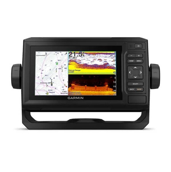
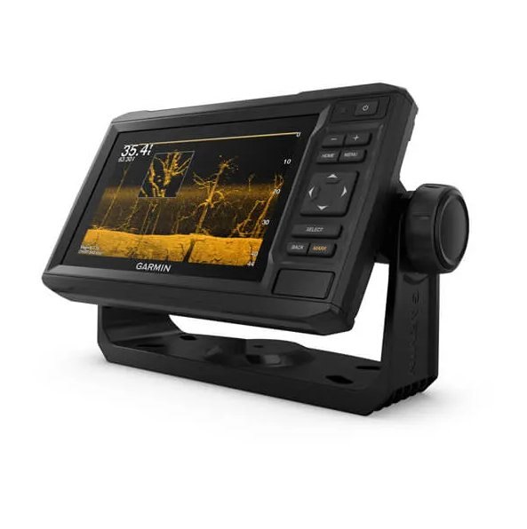
JOIN THE CLUB. FIND MORE FISH. The sunlight-readable 6” chartplotter features a quick-release bail mount, and the transducer bundle adds Ultra High-Definition scanning sonar and CHIRP traditional sonar. |
|
|
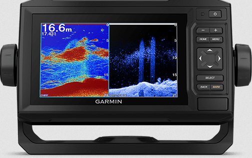
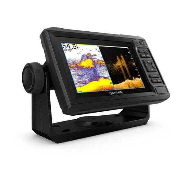
This chartplotter comes with a GT24 transducer for Ultra High-Definition ClearVü scanning sonar, which shows you a crystal-clear image below your boat. Plus, you get Garmin high wide CHIRP traditional sonar for remarkable target separation. |
|
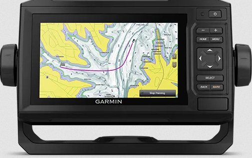
Experience unparalleled coverage and detail with preloaded BlueChart® g3 coastal charts featuring integrated Navionics® data. Charts cover the coastal U.S., including the East and West coasts, Gulf of Mexico and the U.S. and Canadian sides of the Great Lakes. |
|
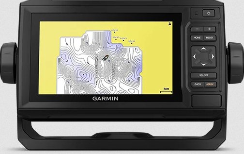
Create personalized fishing maps on-screen with 1’ contours. Keep the data to yourself, or share it with the Quickdraw Community on Garmin Connect™. |
|
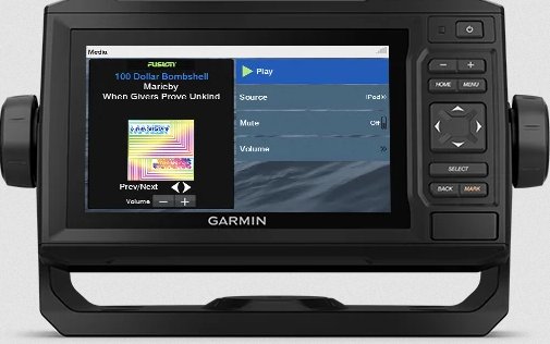
Connect to autopilots, digital switching, weather, FUSION-Link™ audio system, media, VHF, AIS and more from one screen. |
|
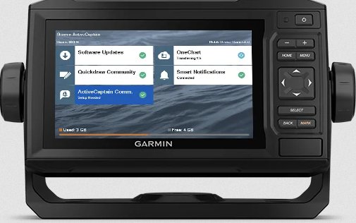
Built-in Wi-Fi® connectivity pairs with the free all-in-one mobile app for access to the OneChart™ feature, smart notifications1, software updates, Garmin Quickdraw™ Community data and more. |
| Dimension | 8.6" x 5.1" x 2.6" (21.8 x 13.0 x 6.2 cm) |
|---|---|
| Input | Keyed |
| Display Size | 5.4" x 3.1"; 6.2" diagonal (13.7 x 7.7 cm; 15.2 cm diagonal) |
| Display Resolution | 800 x 480 pixels |
| Display Type | WVGA, NP |
| Weight |
1.6 lbs (0.7 kg) |
| Waterproof |
IPX7 |
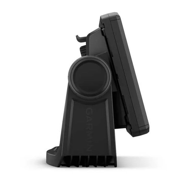
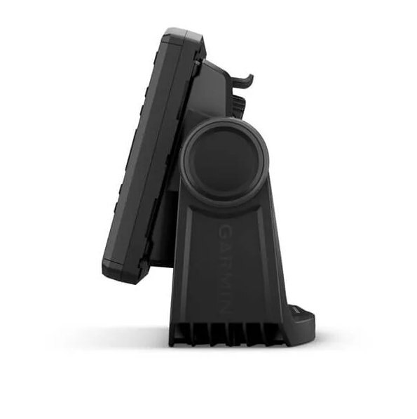
| Mounting Options | Bail or flush |
| Accepts Data Cards |
1 microSD card; 32 GB maximum size |
|---|---|
| Waypoints |
5000 |
| Track points | 50,000 |
| Tracks | 50 saved tracks |
| Navigation Routes | 100 |
| Power output | 500 W |
|---|---|
| Traditional sonar (dual frequency/beam) | built-in (single channel CHIRP, 70/83/200 kHz, L, M, H CHIRP) |
| ClearVü | built-in 260/455/800/1000/1200 kHz |
| NMEA 2000 ports | 1 |
|---|---|
| Connections NMEA0183 Input Ports |
1 |
| NMEA 0183 input (Tx) ports | 1 |
| Power Input | 9 to 18 Vdc |
|---|---|
| Typical current draw at 12 Vdc | 0.7 A |
| Maximum current draw at 12 Vdc | 1.25 A |
| Maximum power usage at 10 Vdc | 12W |
|
With Transducer
|
|
Without Transducer
|